Keeping track of Colorado’s wolves
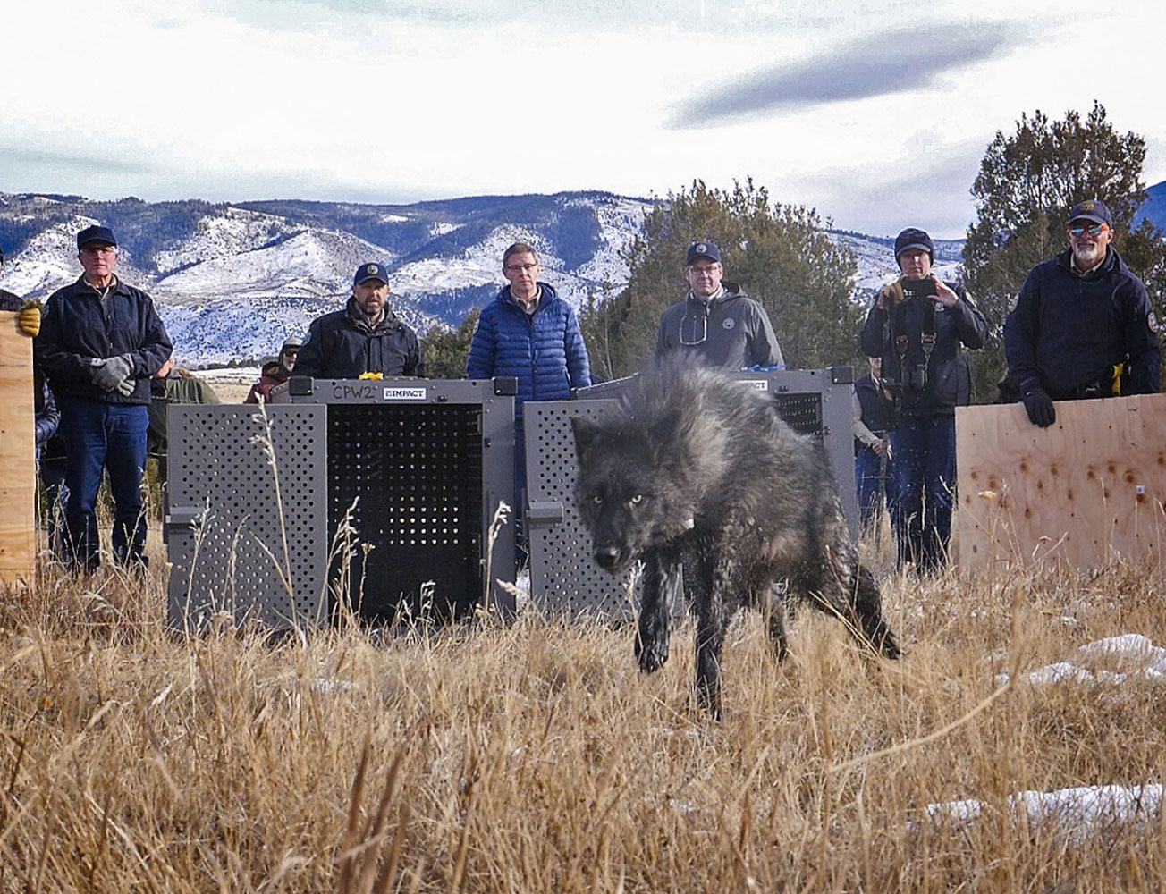
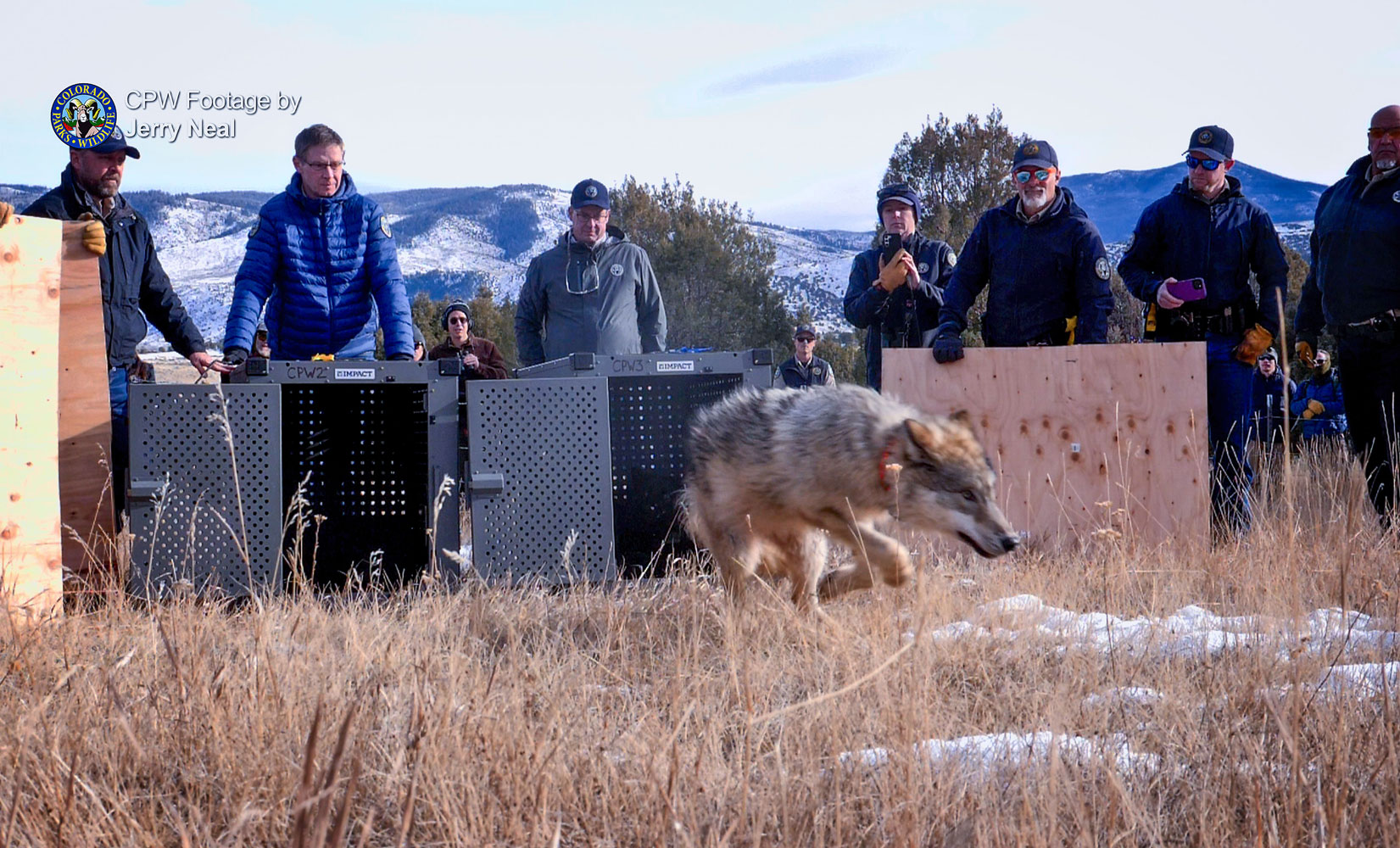
Colorado Parks and Wildlife released five gray wolves onto public land in Grand County, Colorado on Monday, December 18, 2023. Pictured above is wolf 2302-OR and pictured below is 2303-OR.
If you have been following the reintroduction and release of the 12 gray wolves in Colorado, you can follow their whereabouts with a map published by Colorado Parks and Wildlife (CPW). The map informs the public on where the wolves have been making their moves and is updated on the fourth Wednesday of every month on CPW’s website.
Colorado voters approved a ballot initiative in 2020 to reintroduce the wolves on the western slope with the desire to restore ecological balance.
Tracking these large canines is scientific using GPS and water source mapping. Since the wolves wear GPS collars, their movements are programmed to record positions every four hours. By looking at the data, CPW staff can learn where wolves have been, but they cannot tell where the wolves are in real time. To make sure the wolves are protected, CPW does not share specific GPS data. The goal is to inform the public, while protecting detailed accounts of where the wolves have been.
Watersheds are the best mapping units to display wolf activity because wolves use geographic features to decide where they will roam. Water resources are mapped throughout the country and each source is identified by a hydrologic unit code (HUC) or watershed level, according to the United States Geological Survey. A watershed is a geographic unit where all the water drains into a shared body of water, such as a river. Colorado’s designation is HUC 10 and informs agricultural producers to wolf activity.
For a particular watershed to be highlighted to indicate wolf activity, at least one GPS point from the wolf collar has to be recorded within those boundaries. It is an important point because if a watershed indicates wolf activity, it does not mean the wolf or wolves are present within that entire area. For example, according to CPW, a wolf has not yet been located south of I-70, even though the watershed in which a wolf was detected spans both north and south of the interstate.
To learn more about the wolves’ activity, visit https://cpw.state.co.us/learn/Pages/Wolves-Activity-Map.aspx to see the map.
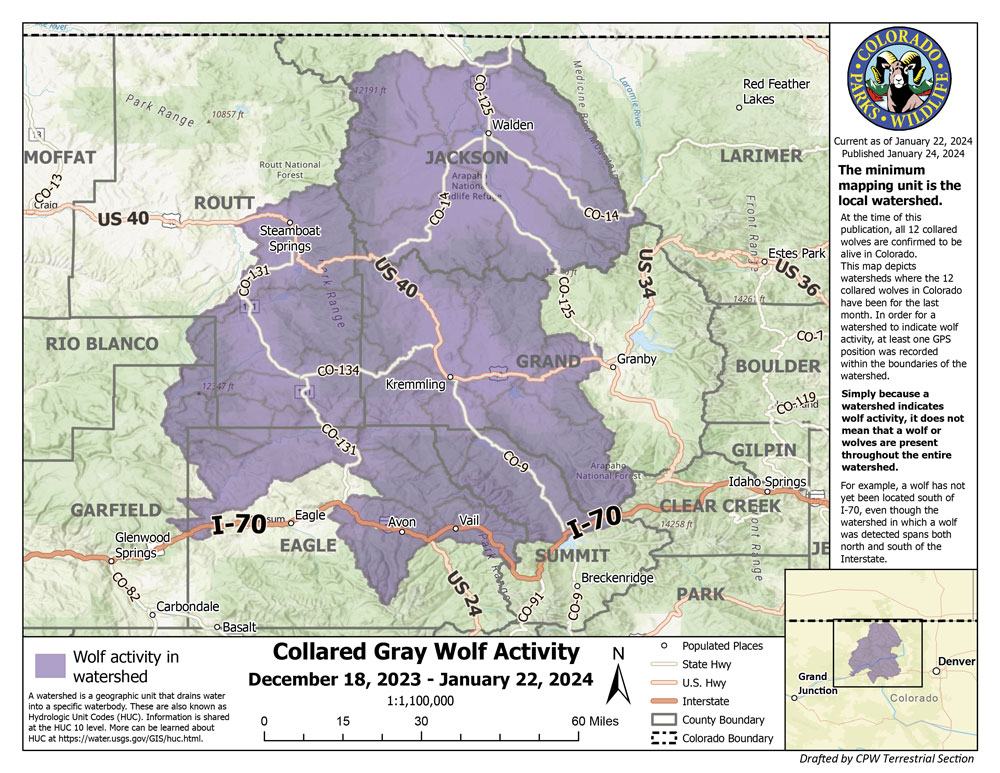
On the fourth Wednesday of every month, CPW releases the latest map of the wolves’ locations.
By Karen Leigh; photos courtesy of Colorado Parks and Wildlife