Round Toppers all

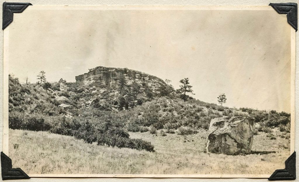
“Mt. Roundy” in 1913, looking to the east, was once used by Native Americans to send smoke signals.
In writing Wildcat Lore over the years, I have sought a home base, a spiritual center of gravity and a location suitable for the “capital” of our readership in these Wildcat Mountains. I finally figured it out: Round Top. We are all “Round Toppers.” Let me take you back a ways…
Our readers’ homes are scattered over the elevated spine of northern Douglas County. Native Americans saw serious value in our heights here well before us. The crossroads were a rendezvous point for tribes journeying to the curative waters around Colorado Springs and along the South Platte River. The ridge was also an ideal place to view the magnificent lands of their Great Spirit. Since one could view most everything for miles around, many of the ridges and hills became beacons or signaling locations.
Douglas County historian Josephine Marr tells us that there was one knoll that fascinated local tribes. It was just “a little bump on the horizon,” but its unique position allowed Native Americans to message by smoke during the day and with signal fires by night. Apparently named first by the Chase family of Happy Canyon, it became “Round Top” to the locals.
Round Top sits a quarter of a mile east of the Happy Canyon northbound ramps. Close up, one is hard-pressed to get excited. It is indeed a rocky knob, an odd, almost bizarre terrain feature, seemingly out of place.
Well after most Native Americans were driven from the area, Douglas County went about establishing schools for its children. There were but three districts in 1865, 23 by 1890. District 31 was named Round Top because its school was sited at the east flank of that curious hill, nestled among chokecherry bushes and scrub oak. Within its white wooden walls, pioneer children were educated by a schoolmarm, following the standard curriculum of the day. It was a social center as well where locals would enjoy basket socials, spelling bees, musicals and dances. On the Sabbath, it housed Sunday school.
In 1897, due to redistricting, a Fred Chase-led school board decided to change the building’s location and moved it a quarter mile to the west. It lasted until 1951, when the building was sold off by auction. One can look westward from the Happy Canyon southbound exit to the first building in the draw. The foundational outline of the relocated schoolhouse sits just below the storage structure on the lower slope of the hill.
What of Round Top today?
“Mt. Roundy” is now within a private property boundary. I have visited the owners, Joni and Mike, several times; they are delighted to own it. From scattered artifacts and vibes, they confirm the knoll as once a center of extensive activity. Local historians feel it was a Native American burial site as well. Joni and Mike also love Castle Rock and have erected their own 20-foot lighted star, which, like the Town’s, they illuminate it over year-end holidays.
Coincidentally, almost directly across and west of I-25 at another high point is the remaining concrete foundation of a 50-foot tower, an airplane signal beacon long gone. Part of early aviation’s first navigational systems, erected in the late 1920s, Round Top and surrounding heights have guided and messaged generations on the ground and in the sky.
By Joe Gschwendtner; photo courtesy of the Porter family album