DCSM students learn there is more than one way to view a map
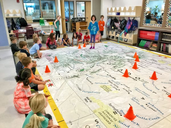
DCSM students got to stand on and move around the National Geographic Traveling Colorado Map while learning mapping skills. The 20’ x 50’ map of Colorado travels the state and is a way to introduce geography and map reading skills to students in an entertaining way.
By Lynne Marsala Basche; photo courtesy of DCS Montessori
Lara Blanchard’s DCS Montessori (DCSM) first- through third-graders had a unique opportunity to learn how to use a grid to locate a point on a map when she brought a piece of National Geographic into her classroom. The students got to stand on, experience and move on the 20’ x 50’ map of Colorado as they got a better sense of the state and learned mapping skills.
The National Geographic Traveling Colorado Map is an educational way to introduce geography and map reading skills to students in an entertaining way. The half-court sized map travels all around Colorado schools and is sponsored by the Colorado Geographic Alliance. Blanchard picked up her map in Highlands Ranch and will deliver it to its next stop in Colorado Springs, and then map will continue to the Western Slope.
“I like this physical map lesson to teach children cartography and basic grid location skills,” said Blanchard. “With online mapping this is a lost skill, even for adults.”
The educational experience of using the traveling map to look at the grid system on a map as Blanchard’s class did engages kids in a meaningful way more so than a traditional text book. “The map was so fun because it was HUGE!,” said student London Lamoureux. “It was super educational, and we learned how to find a specific place on the map by using two grid lines. It was cool!”
Inspiring future explorers begins with captivating their imagination and sparking a desire, which is just what Blanchard and the traveling map did for the DCSM students.