When you come to a fork in the road, take it!
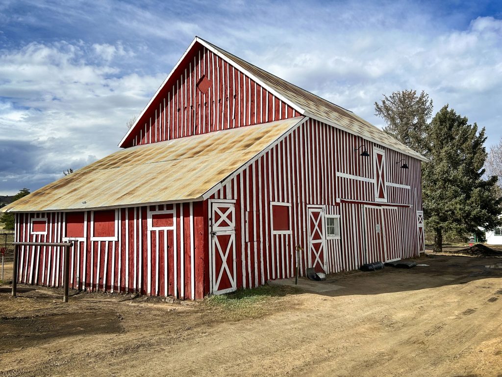
Overstreet Barn, built on upper Jarre parcel built by John Overstreet after marrying Alphonso’s widow. Visible from Highway #67.
The headline comes from Yogi Berra, but it applies equally to the good folks of Jarre Valley and Jarre Canyon.
Douglas County settlers were naturally attracted to water and transportation access: Witness Sedalia’s founder, John Craig, who settled at the confluence of East and West Plum Creeks. The east side of the creeks was undulating and hilly, so those pioneers who came later could go west up Jarre Creek Canyon (SH 67) or south (SH 105) to wider expanses of flatland. Seems that up Jarre was the better move…
Jarre Valley is two and a half miles long and about half a mile wide; on the road one moves from plains to the foothills. Early Jarre Valley homesteaders were disproportionately of English stock and Civil War veterans, both Union and Confederate.
The transition from valley to canyon is marked by outcroppings of red sandstone. One piece in particular, west of the road and just before climbing out, is Bee Rock. Just off the paved route, it is idyllic and a small piece of the entire Monument Ridge that runs from Red Rocks in Denver to Colorado Springs.
Frenchman Alphonso Jarre settled on the upper south side of the valley, first in a log cabin and then, by 1883, in a ranch house. His water rights on the creek were the first recorded in the valley. He married Christina Carlson of Sweden, and they had two children.
The Jarres built up a large herd of cattle, grazed cows in Madge Gulch, and started a small fruit orchard, often going into the canyon to harvest trees for personal use and sale. Prior to Alfonso’s death in 1888, he subdivided his holding, bequeathing the downhill portion of his property to daughter Anne. She married Lou Cramer, a local grain thresher, and their growth together made for a highly prosperous ranch and stock raising business. Some of their original buildings, log cabin included, still remain.
West of the original Jarre property were the McIntyres, Hiram and sister Clarissa, arriving in the mid-1880s. Their barn, still standing today, was used as their home after the first one was ravaged by fire. Hiram was one of the county’s earliest dairymen and the Frink Dairy creamery at Beeman Ranch (at the juncture of SH 67 and SH 105) made for a convenient drop-off point. Eventually Bruce and Frank Penley acquired the McIntyre property and their barn still stands today.
Beyond the valley, past Monument Ridge in the canyon and Pike National Forest, were Sedalians who lived in the wilder parts of the county. The Indian Creek Schoolhouse, also known as Brown’s School, opened in 1884. It is still nicely preserved today, testimony to the fact that more than a few lived in the higher elevations. Perhaps the most famous was William Kreutzer, the first forest ranger in the National Park Service. A mountain in Tin Cup, Colorado, was named after him by the U.S. Secretary of Agriculture.
Mountain lions were common at these higher altitudes and there were more than a few Sedalians who had legitimate motives to hunt them, especially ranchers whose stock could at any time fall prey. Frank Penley is reported to have bagged one measuring eight feet and two inches.
In the late 1870s, Ute Indians, subsisting among Pike Forest Sedalians, came down from the canyon to secure their government-issued rations. Using two long poles with crosspieces between them, they would carry their goods and return again along the Jarre Creek Road.
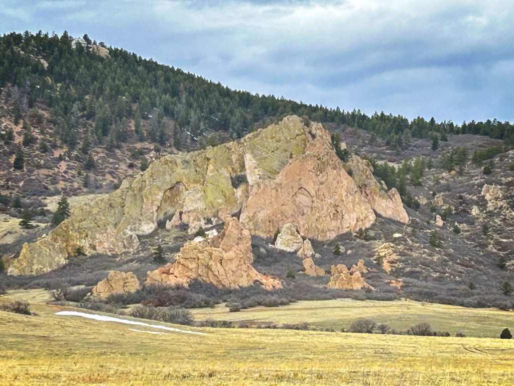
Bee Rock, a small part of the Monument Ridge, on Oak Valley Road, at the transition from Jarre Creek Valley to the Canyon.
Article and photos by Joe Gschwendtner