Trail ratings help to pick the right path
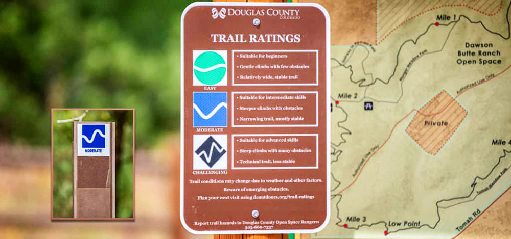
Trails are rated as easy, moderate, or challenging – look for a sign like the one pictured above at open space trailheads throughout the County and then watch for markers at the start of each trail.
Looking for a bit of direction when choosing which path to take at a Douglas County open space properties?
New trail rating signage has been updated at open space properties, helping to ensure that visitors to Douglas County outdoor spaces have a safe and enjoyable experience.
Trail users can consult the posted trail ratings, then choose a trail that offers an appropriate terrain for their skill level, or find something that offers more of a challenge. All trails throughout the County are open for hiking, biking and horseback riding and are rated with all three activities in mind.
County trails are rated by scoring a variety of characteristics, such as maximum elevation and elevation gain or loss, average grade, obstacles, width, slope and stability to determine the difficulty and assign a trail rating.
Trail ratings are marked on all routes at Sandstone Ranch, Dawson Butte, Spruce Mountain and Glendale Open Space, with signs to be added at remaining properties in the coming months.
Getting outdoors and getting active is just one reason Douglas County is consistently ranked as one of the healthiest counties in the country.
For more information about Douglas County properties, visit www.dcoutdoors.org.