Cherry Creek: What’s it to ya?

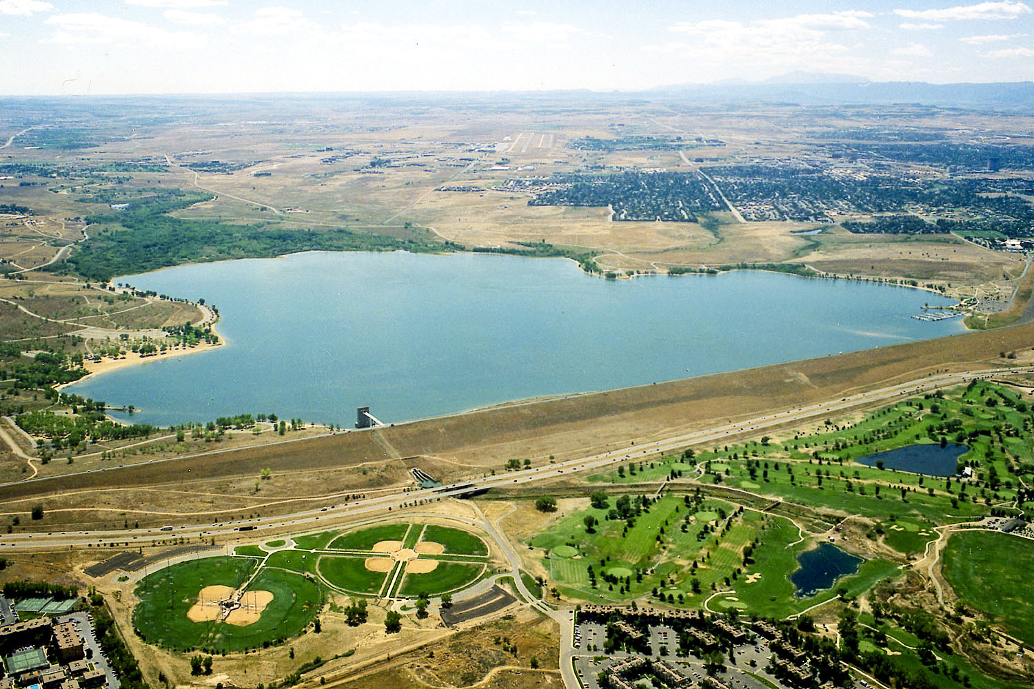
View looking south across Cherry Creek Dam and Lake, which was constructed by the U.S. Army Corps of Engineers and completed in 1950. Photo courtesy of Denver Public Library.
“Cherry Creek” is somewhere and everywhere. Today, it is a school, a dam, a recreational area, a shopping district, a church and more. Cherry Creek’s early fame came in 1859 when tracer gold was found on its banks. It is generally believed that the creek received its name from early settlers who noted the dense chokecherry shrubs (a wild cherry species) growing near its banks. But what indeed do we know about the actual creek itself? Let’s go to the source – literally.
Hard to believe, but Cherry Creek’s headwaters issue from the Palmer Divide, roughly this side of the County Line Road exit on I-25 and north of Monument. The creek itself is a convergence of two separate tributaries (East and West) which come together above Castlewood Canyon, part of the South Platte River Basin. The creek’s waters are from three sources: rain, snowmelt and groundwater springs, seeping from the earth at some 7,400 feet.
On most days, the branches of water are meandering streams, flowing meekly into Denver, but the creek has a dark history.
Corralled in 1890, the Castlewood Canyon Dam was designed by engineer A. M. Welles and built by 85 men, mules and horses and heavy machinery, in less than a year. The dam began to show signs of cracks and seepage as soon as it was finished and some engineers downstream said improvements should be made. Otherwise, the construction turned the creek’s northern banks into a fertile agricultural corridor.
That was until August 3, 1933, when on a quiet night, the Castlewood Canyon Dam collapsed, sending a 15-foot wall of water (one and a half billion gallons) down the canyon and into Denver. This event, but for a Broncos game in today’s era, drew the biggest crowd in history, watching houses and debris barreling down the Speer Boulevard viaduct. Advanced warnings saved many lives.
Prior to the dam collapse, Cherry Creek had irrigated places like the Highland Park Orchards, some 65,000 fruit trees on 800 acres, a square bounded by Holly Street on the west, Havana Street on the east, Quincy Street on the north and Dry Creek Road on the south. I-25’s Orchard Road exit makes sense today; it split Highland Park down the middle. Without controlled water volumes the dam had provided downstream, irrigated acreage of it north reverted to land for grazing cattle.
Clearly, a new solution was needed to control the erratic Cherry Creek. Behind the scenes and heavily influenced by business interests, a New Deal solution was struck, supported by President Franklin Delano Roosevelt himself. Using monies available from the Flood Control Act of 1941, the Cherry Creek Dam and Lake was built by the U.S. Army Corps of Engineers from 1946-1950. It was a massive dirt-moving affair yielding a reservoir for 43 billion gallons of water.
In 1965, another catastrophic rain event deluged the state, devastating areas fed by the Arkansas and South Platte Rivers and their watersheds. In that one, downtown Pueblo was wiped out. Unlike the Castlewood Dam debacle, water behind the Cherry Creek Dam rose 16 feet, but it held fast.
Post-war Denver and her suburbs continued to mature, the biggest catalyst being the construction of I-25, built from 1948-1969. Cherry Creek Dam and Lake, once attracting prospectors, settlers and later a farmers’ lifeline is today a destination for water skiing, boating and paddleboarding.
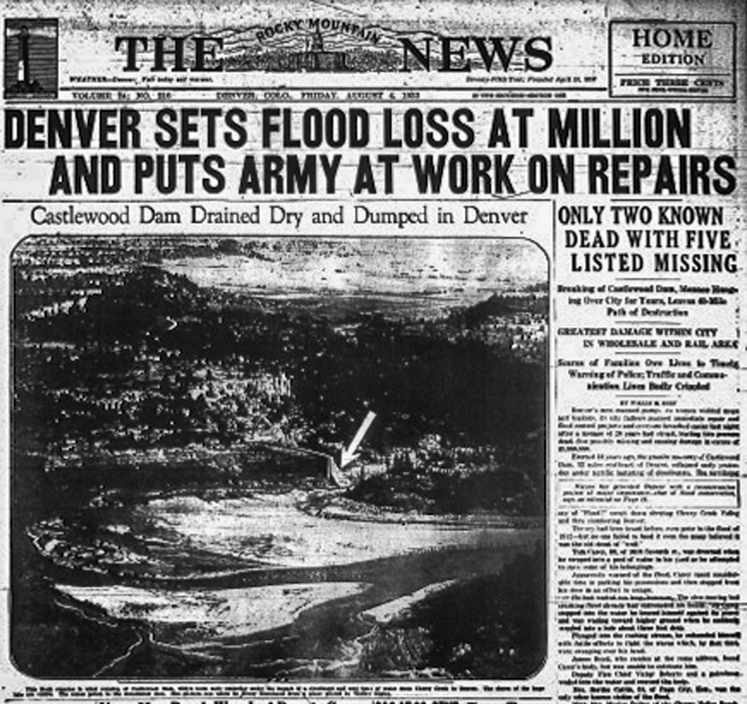
The Rocky Mountain News newspaper front page on August 4, 1933.
By Joe Gschwendtner; courtesy photos