Cherry Creek: An outsized impact on Douglas County

Water is the lifeblood of civilization. Responsibly managed with a rational long-term outlook, it has been of singular importance in the development of our western states.
When first observing the waters of our Cherry Creek, it is hard to see anything other than a seemingly shallow, meandering muddy stream.
Looks deceive. Though not remotely measuring up to the volume or width of the South Platte, Arkansas or Rio Grande, Cherry Creek has played an outsized role in Douglas County history.
Cherry Creek’s waters begin in the high plateaus of northwestern El Paso County, just south of us. Among the earliest adventurers into Kansas Territory (which in those days included all of Kansas, most of Colorado and parts of Nebraska), Cherry Creek was first known as Vermillion Creek and played a significant role in drawing pioneers to both the Smoky Hill and Cherokee Trails.
When some of those pioneers decided to stay, Cherry Creek also became the lifeblood of many a rancher, dairyman and farmer. Though its waters had long served Native Americans, trappers and traders with only scrawny flows at times, the rapid build-up of storms in high country could almost instantly turn her spindly waters into large volumes of rampaging death and destruction. Unpredictable floods created havoc, making for major loss of stock and crops for early settlers.
Thus, there was an early clamor to the young Colorado government for meaningful methods of flood control and irrigation purposes. Our Castlewood Dam was first raised as a solution by the Colorado General Assembly in 1889. Engineering projections hypothesized that such a structure would drain 175 miles of watershed and provide irrigation water for 16,000 acres. Once funded, the dam was built in 11 months, a rubble-filled structure hand-laid between mortared masonry walls. After intermittent leakage problems over the first 10 years of its life and a 1902 repair, things went swimmingly until August 3, 1933.
Torrential rainfall caused the structure’s collapse. A 20-foot wall of water swept down the canyon, eventually reaching Denver. The devastation and loss of life which followed was a tragedy that was long remembered. In a wry and subsequent moment of reflection, a local engineer remarked that “Castlewood Canyon was not worth a dam.”
It took until after World War II before the Cherry Creek Dam project was launched. Catastrophic intermittent flooding had once again become a huge issue, which was only resolved when the U.S. Army Corp of Engineers drew up a plan and oversaw its construction from 1946 to 1950. The reservoir behind the dam has a maximum capacity of 134,000-acre feet with a hydraulic height of 140 feet. Its reservoir provides extensive recreational activities and sees three million visitors per year. The dam’s history is chronicled at two different mile markers known as the 17- and 20-Mile Stage Stops along Parker Road.
Cherry Creek has played an outsized role in the economic success of our area. Its waters and bottomlands make ideal habitats for a host of birds and animals. A good way to appreciate its value is to take the trail to the north, perhaps beginning at Castlewood Canyon and on to Cherry Creek State Park. Many parts of it are tranquil and picturesque… as good as it gets.
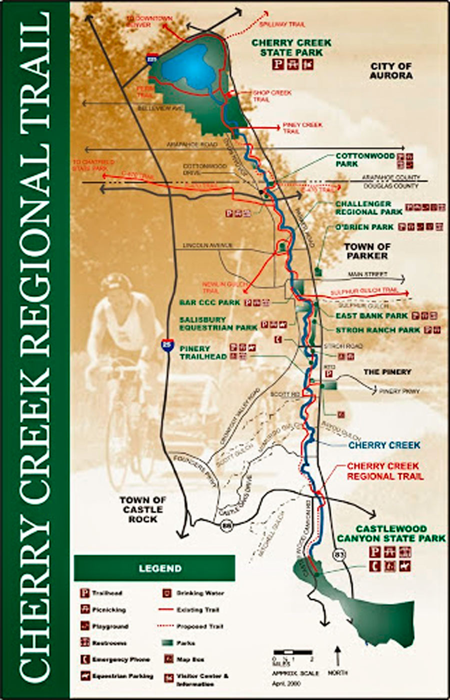
By Joe Gschwendtner; map courtesy of Douglas County Parks and Trails